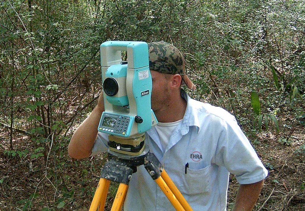
Land surveying is the practice of precisely measuring and mapping the position, elevation, and boundaries of points on the earth’s surface, providing the accurate spatial data that construction, property transactions, and infrastructure planning all depend on. Before any major building project begins, surveyors establish exactly where a structure will sit, how the land slopes, and where legal property boundaries lie, work that underpins nearly every other stage of civil engineering.
What Surveyors Measure
Surveyors measure horizontal distances, vertical elevations, and angles between points to build an accurate picture of the land’s shape and the precise location of existing features such as roads, utilities, and property lines. This data is used to create topographic maps showing elevation changes, establish legal property boundaries for deeds and title transfers, and provide the exact reference points that construction crews use to position foundations, roads, and utilities correctly during building.
Surveying Instruments and Technology
Traditional surveying relied on instruments such as the theodolite, which measures horizontal and vertical angles with high precision, and leveling instruments that establish elevation differences between points. Modern surveying increasingly uses total stations, which combine angle and distance measurement in a single electronic instrument, along with GPS and satellite positioning systems that can establish a point’s location to within centimeters anywhere on earth. Laser scanning and drone-based aerial surveying have further expanded what surveyors can capture, allowing rapid, detailed three-dimensional mapping of large or difficult-to-access sites.
Boundary Surveys and Property Law
Boundary surveys establish the legal limits of a property, resolving where one owner’s land ends and a neighbor’s begins, work that carries significant legal weight since boundary disputes can lead to costly litigation if survey data is inaccurate or improperly recorded. Surveyors research historical deeds, previous survey records, and physical evidence such as old markers or fence lines to reconstruct boundaries that may have been established decades or centuries earlier, often requiring careful interpretation when old records are vague or contradictory.
Surveying in Construction Projects
During construction, surveyors provide the precise reference points, called control points, that guide excavation, foundation placement, and the alignment of roads, pipelines, and buildings, ensuring that a project is built exactly where and how it was designed. As construction progresses, surveyors frequently return to verify that work matches the design plans, catching alignment or elevation errors early before they become expensive to correct once more construction has been completed around them.
Geodetic and Large-Scale Surveying
Beyond individual construction sites, geodetic surveying measures large areas of the earth’s surface, accounting for the planet’s curvature and gravitational variations, work essential for national mapping programs, satellite positioning systems, and scientific studies of tectonic plate movement. This large-scale surveying establishes the reference framework that smaller, local surveys rely on, ensuring that measurements taken in different regions and countries remain consistent and compatible with one another.
History of Surveying
Surveying is an ancient practice, with evidence of land measurement dating back to ancient Egypt, where surveyors reestablished field boundaries after the Nile’s annual flooding, and to the Roman Empire, which used surveying extensively to plan roads, aqueducts, and new settlements across its territory. The development of precise optical instruments in subsequent centuries, followed by electronic and satellite-based positioning in the twentieth century, transformed surveying from a slow, labor-intensive craft into a fast, highly precise science.
Specialized Surveying Applications
Beyond standard construction and boundary work, surveyors support a wide range of specialized needs. Hydrographic surveying maps underwater terrain for navigation channels, port development, and offshore construction, using sonar and other acoustic methods to measure depths that cannot be directly observed. Mining surveyors track excavation progress and verify that underground tunnels and pits are being developed according to plan, while forensic surveyors are sometimes called upon to provide precise measurements as evidence in legal disputes involving property damage, accidents, or boundary disagreements that have escalated into litigation.
Licensing and Professional Standards
Because survey errors can have significant legal and financial consequences, most jurisdictions require land surveyors to be licensed professionals who have completed specific education, examinations, and supervised experience requirements before they can certify official survey documents. A licensed surveyor’s seal on a survey carries legal weight, certifying that the measurements meet professional standards of accuracy and that the surveyor takes responsibility for the work’s correctness, in much the same way that a licensed engineer formally certifies the safety of a structural design.
Geographic Information Systems and Data Integration
Modern surveying data increasingly feeds directly into geographic information systems, digital platforms that store, analyze, and display spatial data layered with other information such as zoning, utility locations, and environmental features. This integration lets planners, engineers, and government agencies combine survey data with other datasets to make more informed decisions about land use, infrastructure investment, and emergency response planning, extending the value of carefully collected survey work well beyond the single original construction or boundary purpose it was first gathered for.
FAQs
Why is GPS important for modern surveying?
GPS and satellite positioning let surveyors establish a point’s precise location, often to within centimeters, far faster than traditional instrument-based methods, making large-scale, remote, and repeat surveying dramatically faster and more efficient than it was with earlier instrument-only methods.
Why do boundary disputes sometimes arise even after a survey?
Older deeds and survey records can be vague, contradictory, or based on physical markers that have since disappeared, requiring careful historical interpretation and professional judgment that can still leave room for genuine disagreement between neighboring property owners.
Quick checkWhy do boundary disputes sometimes arise even after a survey?Show answer
Older deeds and survey records can be vague or based on physical markers that have disappeared, requiring interpretation that can still leave room for disagreement.
Editorially reviewed by Specialty Digest Editorial TeamLast reviewed November 2, 2026Researched and drafted with AI assistanceReport an issue