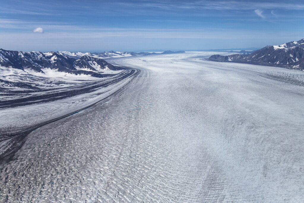
Bering Glacier is a glacier in southern Alaska that ends in Vitus Lake, about 10 km from the Gulf of Alaska. Including the Bagley Icefield that supplies its snow, it is the largest glacier in North America. It is named for Vitus Bering, surges roughly every 20 years and is retreating overall, releasing about 30 cubic kilometers of meltwater a year [1].
| Terminus | Vitus Lake, about 10 km from the Gulf |
|---|---|
| Rank | Largest glacier in North America (with Bagley Icefield) |
| Retreat since 1900 | Up to 12 km (7.5 mi) |
| Surge cycle | About every 20 years |
| Last recorded surge | 1994–95 |
| Annual meltwater | About 30 km³ |
Location
The glacier lies in southern Alaska south of Wrangell-St. Elias National Park and ends in Vitus Lake, with its terminus about 10 km (6.2 miles) from the Gulf of Alaska. Including the Bagley Icefield, it is the largest glacier in North America, and it is named for Vitus Bering [1]. The Bering and Malaspina glaciers both reach the coast along the Gulf; see the entry on the Gulf of Alaska.
Surges
It surges roughly every 20 years, speeding up its flow and advancing the terminus, although retreat generally follows and the glacier shrinks overall. The last recorded surge occurred in winter 1994–95 [1].
Retreat and Thinning
Warmer temperatures and shifting precipitation have thinned it by several thousand meters over the past century, and since 1900 the terminus has pulled back as much as 12 km (7.5 miles). Most glaciers along the Alaskan coast are retreating alongside it [1].
Meltwater
Researchers from the Michigan Tech Research Institute, with the USGS and BLM, estimate about 30 cubic km (7.2 cubic miles) of water is released yearly, more than twice the Colorado River’s volume. It collects in Vitus Lake and flows through the Seal River to the Gulf of Alaska, and scientists track this freshwater input for effects on Gulf currents [1].
Earthquakes and Tectonics
The nearby Wrangell and Saint Elias ranges formed where the Pacific Plate subducts beneath the North American Plate, and glacial retreat reduces the weight on the crust, which may allow faults to move more easily through glacial isostatic adjustment [1]. See the entry on the geology of Alaska.
Related Entries
See the entries on the Hubbard Glacier, the Mendenhall Glacier and the Gulf of Alaska.
FAQs
Where is Bering Glacier? In southern Alaska, ending in Vitus Lake near the Gulf of Alaska.
How large is it? It is the largest glacier in North America when counting the Bagley Icefield.
How often does it surge? Roughly every 20 years.
Is it advancing? No. It is retreating overall.
Who is it named for? Vitus Bering.
Sources
More in Earth Sciences
Key facts
Quick checkIn which lake does Bering Glacier end?Show answer
Vitus Lake
Sources
- Wikipedia. Bering Glacier. 2026 (accessed 2026-11-12)
Editorially reviewed by Specialty Digest Editorial TeamLast reviewed November 12, 2026Researched and drafted with AI assistanceReport an issue