The Dalton Highway is a 414-mile (666 km) road from Livengood, north of Fairbanks, to Deadhorse on the Arctic coast. Built as a supply road for the Trans-Alaska Pipeline, it opened to public traffic along its full length in 1994.[1]
| Length | 414 miles (666 km) |
|---|---|
| Start | Livengood, mile 0 |
| End | Deadhorse, mile 414 |
| Highest point | Atigun Pass, 4,739 ft |
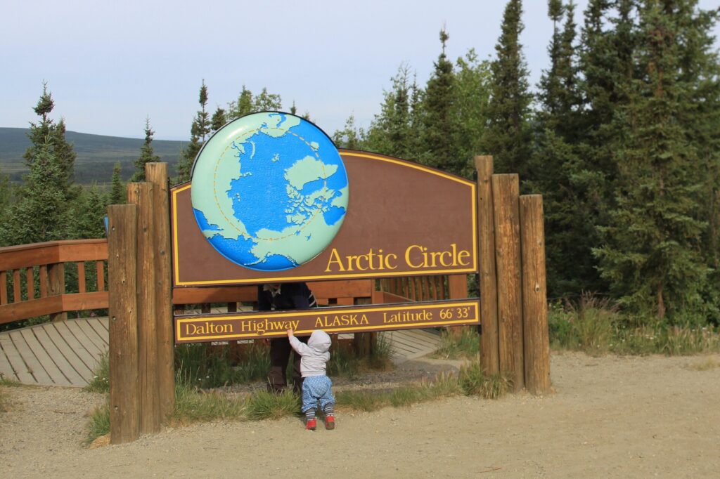
| Arctic Circle | Mile 115 |
Construction
Work resumed on 29 April 1974, and about 390 miles were built within five months as a supply road for the pipeline, completed in 1977. The road opened to the public up to Disaster Creek (mile 211) in 1981, and public access to the full length began in 1994.[1]
Landmarks
The E. L. Patton Yukon River Bridge is at mile 56 and the Arctic Circle Wayside Rest Area at mile 115. Atigun Pass, at mile 244 on the Continental Divide, is the highest point at 4,739 feet.[1]
Services
Fuel is available at the Yukon River Bridge (mile 56), Coldfoot (mile 175) and Deadhorse (mile 414).[1]
Route and length
The Dalton Highway is 414 miles long, signed Alaska Route 11, running from the Elliott Highway near Livengood north of Fairbanks to Deadhorse near Prudhoe Bay and the Arctic Ocean [2].
Construction and name
It was built in 1974 as a supply road for the Trans-Alaska Pipeline, with about 390 miles finished within five months. Also called the North Slope Haul Road, it was named in 1979 for James W. Dalton, an engineer and Arctic engineering consultant [2].
Landmarks
The E. L. Patton Yukon River Bridge crosses the river at mile 56, an Arctic Circle wayside with a viewing deck sits at mile 115, and Atigun Pass, the highest point at 4,739 feet, crosses the Brooks Range [2].
Surface and travel
The road is mostly unpaved gravel, with about 129 miles of pavement as of 2013. Only three communities lie along it: Coldfoot, Wiseman, and Deadhorse. Fuel is available at the Yukon River bridge, Coldfoot, and Deadhorse, grades reach up to 12 percent, and travelers are advised to carry survival gear and drive with headlights on [2].
FAQs
How long is the Dalton Highway? 414 miles.
Why was it built? To supply construction of the Trans-Alaska Pipeline.
Where does it cross the Arctic Circle? At mile 115.
How long is the Dalton Highway? 414 miles [2].
Where is the Arctic Circle on the Dalton Highway? At mile 115 [2].
Sources
Key facts
- Built 1974
- Atigun Pass 4,739 ft
- Open to Deadhorse 1994
Quick checkLength?Show answer
414 miles.
Sources
- Wikipedia. Dalton Highway. 2026 (accessed 2026-11-12)
- Wikipedia. Dalton Highway. 2026 (accessed 2026-11-14)
Editorially reviewed by Specialty Digest Editorial TeamLast reviewed November 12, 2026Researched and drafted with AI assistanceReport an issue