Aniakchak National Monument and Preserve on the Alaska Peninsula covers 601,294 acres and is centered on a caldera about 6 miles across. It was proclaimed a national monument on 1 December 1978 and established as a monument and preserve on 2 December 1980.[1]
| Total area | 601,294 acres |
|---|---|
| Monument | 137,176 acres |
| Preserve | 464,118 acres |
| Caldera | About 6 miles across, formed about 3,700 years ago |
The caldera
The rim’s high point, Aniakchak Peak, is about 4,380 feet, and the floor at the outlet of Surprise Lake is about 1,055 feet. Surprise Lake is the source of the Aniakchak River, which flows about 30 miles to Aniakchak Bay.[1]
1931 eruption
In May 1931 the Half Cone cinder cone erupted, sending ashfall up to 300 miles away and forming Vent Mountain, the most recent eruption site inside the caldera.[1]
Establishment and size
President Jimmy Carter proclaimed the monument on December 1, 1978, under the Antiquities Act, and it became a monument and preserve on December 2, 1980, when ANILCA set its final boundaries. It covers 601,294 acres, of which 137,176 acres are monument and 464,118 acres preserve [2].
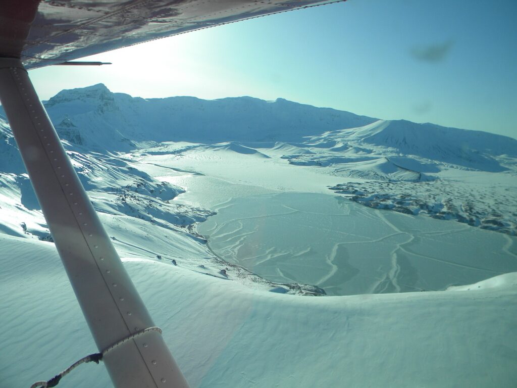
Caldera and Surprise Lake
The caldera is about 6 miles in diameter and the summit crater about 3,300 feet deep. The original mountain was about 7,000 feet tall and collapsed into its magma chamber about 3,700 years ago. Surprise Lake lies inside the caldera and is the source of the Aniakchak River, which flows about 30 miles to Aniakchak Bay and can be navigated by raft or kayak [2].
1931 eruption
Half Cone, a cinder cone inside the caldera, erupted in May 1931 and caused ashfall up to 300 miles away. Publicity from the eruption helped spur the studies that led to monument designation. Father Bernard R. Hubbard expeditions from 1930 to 1932 publicized the area [2].
Wildlife and history
Land animals include caribou, moose, brown bears, wolves, and wolverines, and marine mammals include harbor seals, sea lions, and sea otters. Russian exploration began in the mid-1700s, followed by sea otter fur traders, and salmon fishing, fish traps, and canneries operated in Aniakchak Bay from the late 1800s through 1949. The Aniakchak Bay Historic Landscape District was listed on the National Register of Historic Places in 1997 [2].
Visitation
It is the least visited area in the National Park System, with remote location and difficult weather limiting access. Most visitors fly into Surprise Lake, though landings are often hampered by fog [2].
FAQs
How big is Aniakchak? 601,294 acres.
How wide is the caldera? About 6 miles.
When was the last eruption? 1931.
When was Aniakchak established? Proclaimed December 1, 1978, with final boundaries set December 2, 1980 [2].
How wide is the caldera? About 6 miles in diameter [2].
Sources
- Wikipedia: Aniakchak National Monument and Preserve
- Wikipedia: Aniakchak National Monument and Preserve
Key facts
- 601,294 acres
- 6-mile caldera
- Eruption 1931
Quick checkLast eruption?Show answer
1931.
Sources
- Wikipedia. Aniakchak National Monument and Preserve. 2026 (accessed 2026-11-12)
- Wikipedia. Aniakchak National Monument and Preserve. 2026 (accessed 2026-11-14)
Editorially reviewed by Specialty Digest Editorial TeamLast reviewed November 12, 2026Researched and drafted with AI assistanceReport an issue