The Alaska Peninsula extends about 497 miles (800 km) southwest from mainland Alaska and ends in the Aleutian Islands, separating the Pacific Ocean from Bristol Bay. A very active volcanic range, the Aleutian Range, runs its full length. It holds Katmai National Park and Preserve, Aniakchak National Monument, Becharof and Izembek National Wildlife Refuges and some of the largest sockeye salmon runs in the world [1].
| Length | About 497 miles (800 km) |
|---|---|
| Other names | Aleutian Peninsula; Alaxsxîx̂ (Aleut) |
| Most active volcano | Pavlof, over 8,251 ft |
| Protected areas | Katmai, Aniakchak, Becharof, Izembek, Alaska Peninsula NWR |
| Borough | Lake and Peninsula Borough |
| Precipitation | 24–65 in a year |
Geography
The peninsula extends about 497 miles southwest from mainland Alaska, from the end of the Alaska Range to the Aleutian Islands. Its Aleut name is Alaxsxîx̂. It separates the Pacific Ocean from Bristol Bay, an arm of the Bering Sea, and the Lake and Peninsula Borough covers most of its territory [1].
Volcanoes and Geology
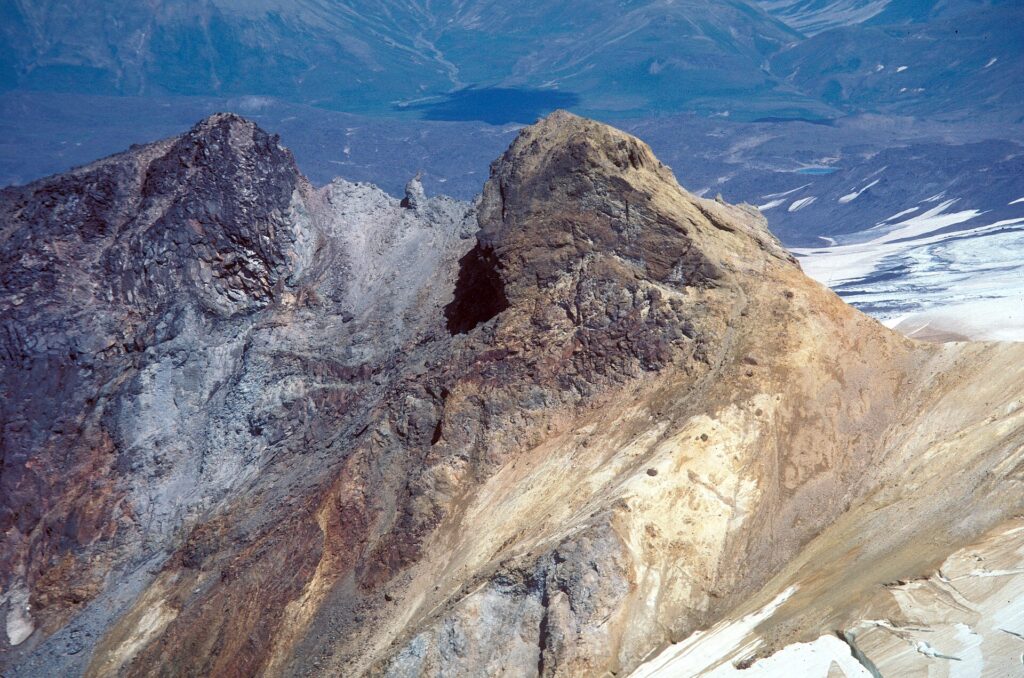
The Aleutian Range runs the full length of the peninsula and is very active. Pavlof Volcano is the most active in the range, rising more than 8,251 feet. The southern side is rugged and mountainous, uplifted as the North Pacific Plate subsides beneath the North American Plate, while the northern side is generally flat and marshy [1]. Katmai and Novarupta are among its volcanoes; see the entry on Novarupta and the 1912 Katmai eruption.
Coasts
The Bristol Bay coast is turbid, muddy and shallow with strong tidal extremes. The Pacific coast has small tides and deep, clear water, and both coasts face intense storms, wind and rain [1].
Climate
Annual precipitation ranges from 24 to 65 inches. Winter averages run from 12 to 34 °F and summer averages from 43 to 59 °F, and frost can occur on any day of the year at higher elevations. The climate has been compared to parts of Scotland, Iceland and Tierra del Fuego [1].
Protected Areas
The peninsula includes Katmai National Park and Preserve, Aniakchak National Monument and Preserve, Becharof National Wildlife Refuge, Alaska Peninsula National Wildlife Refuge and Izembek National Wildlife Refuge [1].
Wildlife
Brown bear populations are notable at McNeil River and Katmai, partly because of the region’s salmon runs. Sockeye salmon runs are among the world’s largest, and caribou, moose, wolves, waterfowl and willow ptarmigan also live there, with large seabird colonies along the coast [1].
Communities
Villages include Cold Bay, King Cove, Perryville, Chignik, Chignik Lake, Chignik Lagoon and Port Moller. Most residents are Alaska Natives, and most communities depend largely on fishing [1]. See the entries on Southwest Alaska and the Aleutian Islands.
FAQs
How long is the Alaska Peninsula? About 497 miles (800 km).
What is the most active volcano? Pavlof Volcano.
What parks are on it? Katmai, Aniakchak, Becharof, Izembek and the Alaska Peninsula refuge.
What do residents depend on? Mostly fishing.
What water bodies bound it? The Pacific Ocean and Bristol Bay.
Sources
More in Human Geography
Key facts
Quick checkWhich volcano is the most active on the Alaska Peninsula?Show answer
Pavlof Volcano
Sources
- Wikipedia. Alaska Peninsula. 2026 (accessed 2026-11-12)
Editorially reviewed by Specialty Digest Editorial TeamLast reviewed November 12, 2026Researched and drafted with AI assistanceReport an issue