The Alaska Range is a mountain range in southern Alaska and Yukon about 600 miles (970 km) long, running from Lake Clark in southwestern Alaska to the White River in Yukon. It contains Denali, at 20,310 feet (6,190 m) the highest mountain in North America, and it is among the highest ranges in the world after the Himalayas and the Andes [1].
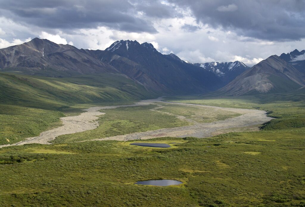
| Length | About 600 miles (970 km) |
|---|---|
| Highest peak | Denali, 20,310 ft (6,190 m) |
| Second highest | Mount Foraker, 17,400 ft |
| Southern fault | Denali Fault |
| Passes | Windy, Isabel, Mentasta |
| Protected areas | Denali, Wrangell-St. Elias, Lake Clark |
Size and Location
The range runs about 600 miles from Lake Clark to the White River in Yukon, Canada, and is among the highest in the world after the Himalayas and the Andes [1].
Major Peaks
After Denali (20,310 ft), the main peaks are Mount Foraker (17,400 ft), Mount Hunter (14,573 ft), Mount Hayes (13,832 ft), Mount Silverthrone (13,218 ft), Mount Moffit (13,020 ft), Mount Huntington (12,240 ft) and Mount Russell (11,670 ft) [1].
Geology
The Denali Fault runs along the range’s southern edge and is responsible for many major earthquakes. The range is part of the Pacific Ring of Fire, and Mount Spurr, a stratovolcano at the northeastern end of the Aleutian Volcanic Arc, has two vents [1]. See the entry on the geology of Alaska.
Climate and Glaciers
The mountains block moist air moving north from the Gulf of Alaska, producing some of the harshest weather in the world. Heavy snowfall feeds large glaciers, including the Cantwell, Castner, Black Rapids, Susitna, Muldrow, Ruth and Kahiltna [1].
Rivers, Passes and Highways
Four major rivers cross the range: the Delta and Nenana in the center and the Nabesna and Chisana to the east. The George Parks Highway crosses Windy Pass between Anchorage and Fairbanks, the Richardson Highway crosses Isabel Pass between Valdez and Fairbanks, with the pipeline parallel, and the Tok Cut-Off crosses Mentasta Pass [1].
Protected Areas
Parts of the range lie within Wrangell-St. Elias National Park and Preserve, Denali National Park and Preserve and Lake Clark National Park and Preserve [1]. See the entry on Denali.
Exploration and Naming
H. T. Allen led the first recorded expedition in the eastern range in 1885. In 1898 W. C. Mendenhall and E. F. Glenn traversed Isabel Pass, and Robert Muldrow and George Homans Eldridge crossed Broad Pass and Windy Pass into the Nenana River valley. W. H. Dall first applied the name Alaskan Range in 1869 [1]. James Wickersham led an 1903 attempt to climb Denali [2].
FAQs
How long is the Alaska Range? About 600 miles (970 km).
What is its highest peak? Denali, 20,310 feet.
What fault runs along it? The Denali Fault.
Which highways cross it? The George Parks, Richardson and Tok Cut-Off highways.
Which parks include it? Denali, Wrangell-St. Elias and Lake Clark.
Sources
More in Earth Sciences
Key facts
Quick checkWhich peak in the Alaska Range is the highest in North America?Show answer
Denali
Sources
- Wikipedia. Alaska Range. 2026 (accessed 2026-11-12)
- Wikipedia. James Wickersham. 2026 (accessed 2026-11-12)
Editorially reviewed by Specialty Digest Editorial TeamLast reviewed November 12, 2026Researched and drafted with AI assistanceReport an issue