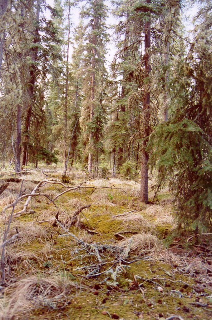
Taiga, or boreal forest, is the world’s largest land biome after the tundra, covering about 17 million square kilometres, or 11.5 percent of Earth’s land. In Alaska it fills the Interior between the Alaska Range and the Brooks Range.[3]
| Global extent | About 17 million km² |
|---|---|
| Interior Alaska–Yukon lowland taiga | About 171,200 sq mi |
| Mean annual temperature | About −10 °C |
| Fire rotation | About 50–100 years |
| Bounded by | Brooks Range and Alaska Range |
Extent and terrain
The Interior Alaska–Yukon lowland taiga covers about 171,200 square miles, mostly in Alaska, from the Bering Sea in the west to the Richardson Mountains in the east. Elevations run from sea level to about 600 metres, and slopes are usually gentle, with nearly flat bottomlands along the major rivers.[1]
Trees and soils
Spruce forests cover most of the region. White spruce favours warmer, drier sites and black spruce tolerates poorly drained soils. Willow and alder colonise river meanders, followed by balsam poplar and quaking aspen, which spruce eventually replaces. Soils are shallow above continuous to discontinuous permafrost, except along rivers.[1]
Climate
The climate is continental, with short, warm summers and long, cold winters. Mean annual temperature is about −10 °C, and precipitation is about 250 to 550 millimetres, dropping to about 170 millimetres in the upper Yukon Flats. Around Fairbanks the frost-free season has lengthened from 60–90 days to about 120 days.[3]
Fire and change
Lightning-caused fires are common, and fire is the main natural disturbance, with rotations of roughly 50 to 100 years. At Bonanza Creek Long-Term Ecological Research site, researchers tracked recovery at 89 Interior sites for 13 years after a widespread fire season and found that aspen and birch seedlings could outgrow black spruce after severe burns, suggesting a possible shift from spruce to deciduous or mixed forest.[2]
Wildlife
Moose, caribou, lynx, snowshoe hare, wolves, and grizzly and black bears live here, with waterfowl, sandhill cranes and eagles. The Porcupine, Central Arctic and Western Arctic caribou herds migrate through or winter in the region, and Chinook salmon spawn in the Porcupine River. The Yukon Flats supports an estimated 15 to 20 percent of the canvasback population.[1]
History and protection
Alaska was not covered by the Laurentide Ice Sheet, and the area was part of a Bering Sea refugium, so parts of the Interior taiga have a long ecological history.[3] The ecoregion is rated relatively stable and intact. Protected areas include the Yukon Flats, Kanuti, Koyukuk, Innoko, Nowitna and Arctic national wildlife refuges, most designated under the 1980 Alaska National Interest Lands Conservation Act.[1]
FAQs
What is taiga? Boreal forest dominated by conifers such as spruce.
How often does it burn in Alaska? Fire rotations are roughly 50 to 100 years.
Has the growing season changed? Around Fairbanks the frost-free season has lengthened to about 120 days.
Which trees dominate? White and black spruce, with aspen, birch and poplar on disturbed sites.
Sources
- World Wildlife Fund: Interior Alaska–Yukon lowland taiga
- National Science Foundation: Wildfires are changing forest communities in interior Alaska
- Wikipedia: Taiga
Key facts
- 171,200 sq mi ecoregion
- Fire rotation 50–100 years
Quick checkHow often does Alaska’s taiga burn?Show answer
Roughly every 50 to 100 years
Sources
- World Wildlife Fund. Interior Alaska–Yukon lowland taiga. 2026 (accessed 2026-11-12)
- National Science Foundation. Wildfires are changing forest communities in interior Alaska. 2026 (accessed 2026-11-12)
Editorially reviewed by Specialty Digest Editorial TeamLast reviewed November 12, 2026Researched and drafted with AI assistanceReport an issue