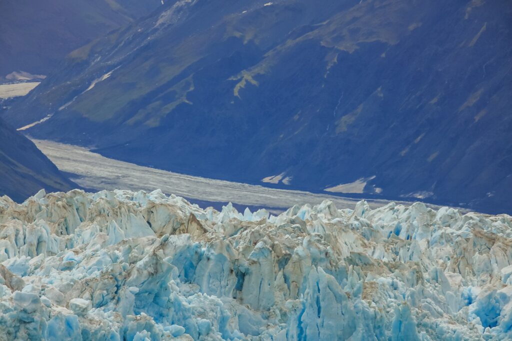
The glaciers of Alaska cover thousands of square miles, with large concentrations in the coastal mountains of the south and southeast, and they are among the most closely studied ice masses on Earth. Land glacier ice covers about 16,000 square miles, and another 1,200 square miles of glacier ice lies in the tidal zone. Satellite mapping published by the National Park Service shows that glacier-covered area in Alaska shrank by about 13 percent between 1985 and 2020, with the largest losses in southcentral Alaska [1][2].
| Land glacier ice | About 16,000 square miles |
|---|---|
| Tidal-zone glacier ice | About 1,200 square miles |
| Bering Glacier complex | About 2,250 square miles |
| Area change 1985–2020 | −8,425 km² (−13 percent) |
| Largest losses | Southcentral Alaska |
| Little change | Brooks Range |
How Much Ice?
Alaska has about 16,000 square miles (41,000 km²) of land glacier ice and about 1,200 square miles (3,100 km²) of glacier ice in the tidal zone. The Bering Glacier complex alone covers about 2,250 square miles (5,800 km²) [1].
Major Ice Fields and Glaciers
The state’s largest ice masses are found in the Chugach, Wrangell and St. Elias Mountains and in the coastal ranges of Southeast Alaska. National parks protect many of them. Wrangell–St. Elias National Park includes the Nabesna Glacier, about 53 miles long, the Malaspina Glacier, which is larger than Rhode Island, and Hubbard Glacier, one of North America’s most active tidewater glaciers [3]. Glacier Bay holds about 1,059 glaciers, and Kenai Fjords is shaped by the Harding Icefield [4][5]. Each is covered in its own entry in this encyclopedia.
A Changing Ice Cover
A 2022 National Park Service article describing a mapping study found that Alaska’s glacier-covered area shrank by 8,425 km², a loss of 13 percent, between 1985 and 2020, an average of about 240 km² per year. The largest net loss occurred in heavily glaciated southcentral Alaska, while the Brooks Range showed little change [2].
Where Losses Occur
The mapping indicated that the largest losses occurred at elevations of 800 to 2,200 meters and, most recently, in the last decade [2]. Mean annual temperatures have risen faster in the last decade, and the decline of the glaciers is linked to a warming climate across Alaska and the high latitudes [2].
Debris-Covered Ice
The same study found that supraglacial debris, meaning rock and soil on the surface of glaciers, expanded by 2,799 km², an increase of 64 percent over the same period [2]. Debris cover can change how fast ice melts and complicates mapping.
Mapping Method
The study used a deep neural network called GlacierCoverNet, trained on a purpose-built dataset, to produce 18 maps at two-year intervals. Error rates were about 6 percent omission and 9 percent commission in southern Alaska, and higher in the northern Brooks Range where glaciers are small and hard to map [2].
Glaciers in the Parks
Alaska’s national parks contain a large share of the state’s glaciers. In Glacier Bay, researchers found about 11 percent less glacial ice than in the 1950s, though heavy snowfall in the Fairweather Mountains keeps a few glaciers stable [4]. In Kenai Fjords, glaciers lost 11.2 percent of their ice between 1950 and 2005 [5].
Why It Matters
Glacier meltwater feeds rivers, supports salmon habitat, influences coastal waters and contributes to the rise of sea level. Glaciers are also tourist attractions, and their retreat is visible in places like the Mendenhall Glacier near Juneau [1][6].
Glaciers and Ecosystems
Glaciers shape Alaska’s landscapes and waters. Meltwater feeds rivers that support salmon, deposits sediments in estuaries and influences the temperature of coastal waters. As glaciers retreat they expose new land that is colonized by plants and animals, as the record of Glacier Bay shows, where retreat since about 1750 has opened about 65 miles of bay [4].
Tidewater and Land-Terminating Glaciers
Alaska has glaciers of several types. Tidewater glaciers, such as Hubbard Glacier and the seven active tidewater glaciers of Glacier Bay, end in the sea and shed icebergs. Land-terminating glaciers such as Exit Glacier in Kenai Fjords end on land, while piedmont glaciers such as the Malaspina spread out across lowlands [3][4][5].
Monitoring Change
Researchers monitor glaciers using satellite imagery, aircraft surveys and field measurements. The 2022 National Park Service study used machine learning to map glacier cover every two years, producing 18 maps and giving a consistent record from 1985 to 2020 [2]. In Kenai Fjords, park scientists track the glaciers fed by the Harding Icefield [5].
Public Interest
Glaciers draw visitors from around the world to Alaska, and the rapid change of well-known glaciers has made them a visible symbol of climate change. Visitors to Juneau can see the retreating Mendenhall Glacier from local roads [6], and cruise ships visit Glacier Bay and Hubbard Glacier each summer.
FAQs
How much of Alaska is covered by glaciers? About 16,000 square miles of land glacier ice plus about 1,200 square miles in the tidal zone.
Are Alaska’s glaciers shrinking? Yes. A mapping study found glacier-covered area shrank by 13 percent between 1985 and 2020.
Where are the biggest losses? In southcentral Alaska, according to the National Park Service study.
What is the largest glacier complex in Alaska? The Bering Glacier complex, about 2,250 square miles.
Which Alaska glaciers have little change? Glaciers in the Brooks Range showed little change in the mapping study.
Sources
- Wikipedia: Geography of Alaska
- National Park Service: Alaska Glacier Change
- National Park Service: What’s So Special about Wrangell-St. Elias
- National Park Service: Glacier Bay’s Glacial History
- National Park Service: Kenai Fjords Fact Sheet 2021
- Wikipedia: Juneau, Alaska
More in Earth Sciences
Key facts
Quick checkBy what percent did Alaska glacier area shrink from 1985 to 2020?Show answer
13 percent
Sources
- Wikipedia. Geography of Alaska. 2026 (accessed 2026-11-12)
- National Park Service. Alaska Glacier Change. 2022 (accessed 2026-11-12)
- National Park Service. What’s So Special about Wrangell-St. Elias. 2026 (accessed 2026-11-12)
- National Park Service. Glacier Bay’s Glacial History. 2026 (accessed 2026-11-12)
- National Park Service. Kenai Fjords Fact Sheet 2021. 2021 (accessed 2026-11-12)
- Wikipedia. Juneau, Alaska. 2026 (accessed 2026-11-12)
Editorially reviewed by Specialty Digest Editorial TeamLast reviewed November 12, 2026Researched and drafted with AI assistanceReport an issue