The Aleutian Range is a mountain range in southwest Alaska that runs about 600 miles from Chakachamna Lake, 80 miles southwest of Anchorage, to Unimak Island at the tip of the Alaska Peninsula. It contains a large number of active volcanoes that are part of the Aleutian Arc, including Redoubt at 10,197 feet, Iliamna, Shishaldin, Pavlof and Veniaminof [1][2].
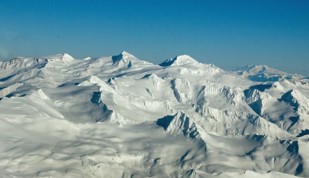
| Length (mainland) | About 600 miles |
|---|---|
| Highest peak | Mount Redoubt, 10,197 ft |
| Second highest | Mount Iliamna, 10,016 ft |
| Shishaldin | 9,373 ft, Unimak Island |
| Subduction rate | About 59 mm per year |
| Aleutian Islands | Submerged western extension, about 1,000 miles |
Extent
The range runs from Chakachamna Lake to Unimak Island and includes all the mountains of the Alaska Peninsula. The Aleutian Islands are, geologically, a partially submerged western extension stretching roughly 1,000 miles further. The range is almost entirely roadless wilderness [1].
Principal Peaks
Mount Redoubt is the highest at 10,197 feet and Mount Iliamna second at 10,016 feet, both in the Chigmit Mountains. Mount Neacola reaches 9,426 feet, Mount Shishaldin on Unimak Island 9,373 feet, Mount Pavlof 8,264 feet and Mount Veniaminof 8,225 feet. Mount Katmai is 6,716 feet [1].
Eruptions
Mount Okmok erupted on July 12, 2008, and continued for about a month, sending an ash and gas cloud to about 15,240 meters. Mount Kasatochi erupted on August 7–8, 2008. Together the eruptions moved about 1.6 teragrams of sulfur dioxide into the stratosphere and briefly disrupted flights [1].
Redoubt and Iliamna
Mount Redoubt erupted in 1989 and 2009. In 1989 its ash cloud caused all four engines of KLM Flight 867 to fail at 25,000 feet. Mount Iliamna has active fumaroles that sometimes release visible vapor [2]. Both lie in or near Lake Clark National Park and Preserve; see that entry.
Plate Tectonics
A magnitude 7.9 earthquake struck the Aleutian Islands in June 2014 at an intermediate depth of 107 km. It resulted from oblique normal faulting along the Aleutian Trench, where the Pacific plate subducts beneath the North American plate at about 59 mm per year [1].
Pavlof and the Peninsula
Pavlof Volcano is the most active in the range and rises more than 8,251 feet on the Alaska Peninsula [3]. See the entries on the Alaska Peninsula, Novarupta and the 1912 Katmai eruption, and the geology of Alaska.
FAQs
What is the highest peak in the Aleutian Range? Mount Redoubt, at 10,197 feet.
Which volcano is the most active? Pavlof, according to the Alaska Peninsula source.
How is the range related to the Aleutian Islands? The islands are its partly submerged western extension.
How fast does the plate subduct? About 59 millimeters per year.
Is the range accessible by road? No. It is almost entirely roadless wilderness.
Sources
- Wikipedia: Aleutian Range
- Wikipedia: Lake Clark National Park and Preserve
- Wikipedia: Alaska Peninsula
More in Earth Sciences
Key facts
Quick checkWhich Aleutian Range peak is the highest?Show answer
Mount Redoubt
Sources
- Wikipedia. Aleutian Range. 2026 (accessed 2026-11-12)
- Wikipedia. Lake Clark National Park and Preserve. 2026 (accessed 2026-11-12)
- Wikipedia. Alaska Peninsula. 2026 (accessed 2026-11-12)
Editorially reviewed by Specialty Digest Editorial TeamLast reviewed November 12, 2026Researched and drafted with AI assistanceReport an issue