Baranof Island in Southeast Alaska covers about 1,607 square miles, making it the 8th largest island in Alaska and the 10th largest in the United States. Sitka lies on its western shore, and nearly all of the island is in the City and Borough of Sitka.[1]
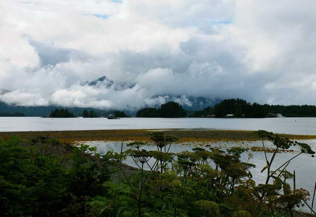
| Area | 1,607 sq mi |
|---|---|
| Rank | 8th in Alaska, 10th in U.S. |
| Highest point | Peak 5390, 5,390 ft |
| Population (2000) | 8,532 |
Geography
Peak 5390, at 5,390 feet, is the highest mountain in the Alexander Archipelago. A small southeastern sliver including Port Alexander lies in the Petersburg Borough.[1]
History
Russian naval captain Yuri Lisianski named the island in 1805 for Alexander Baranov, and the Tlingit name is Shee. Baranov founded the first European settlement there in 1799, and from 1804 to 1867 the island was the center of Russian activity in North America and the headquarters of the Russian fur trade, which centered on sea otter pelts. The United States bought Russian Alaska in 1867 for $7.2 million.[1]
Size and rank
Baranof Island covers about 1,607 square miles (4,160 square km), slightly larger than Rhode Island, with a shoreline of about 617 miles. It is the 8th largest island in Alaska and the 10th largest in the United States, and the smallest of the ABC Islands. It lies in the northern Alexander Archipelago in the Alaska Panhandle [2]. Peak 5390, at 5,390 feet (1,643 m), is the highest mountain in the Alexander Archipelago, and most of the island lies in the Tongass National Forest, with much of it designated as the South Baranof Wilderness [2].
Communities
Nearly all of the island is in the City and Borough of Sitka, the borough seat. A small southeastern corner lies in the Petersburg Borough and includes Port Alexander. Other eastern-shore communities include Baranof Warm Springs, Port Armstrong, and Port Walter, and five year-round salmon hatcheries operate on the island [2].
Name and Tlingit history
Captain U. F. Lisianski named the island Baranof in 1805 in honor of Alexander Baranov. In Tlingit it is called Shee, also Shee Atika. The Tlingit are the Indigenous people of the island, who fished, hunted, trapped, and traded furs, copper, and dried fish [2].
Russian era
Baranov founded the first European settlement on the island in 1799, and from 1804 to 1867 it was the center of Russian activity in North America and headquarters of the Russian fur trade, mainly sea otter pelts. In 1802 the Tlingit attacked the Russian outpost Redoubt Saint Michael, and hostilities between the Russians and Tlingit continued until 1855. Russia sold Alaska to the United States in 1867 for $7.2 million [2].
Wildlife
Notable species include brown bears, Sitka black-tailed deer, sea otters, Steller sea lions, mountain goats, and humpback whales. The southern tip is a Steller sea lion breeding ground and part of the Alaska Maritime National Wildlife Refuge. Mainland goats were transplanted to Bear Mountain in 1924 [2].
FAQs
What city is on Baranof Island? Sitka.
What is the highest point? Peak 5390, at 5,390 feet.
Who is it named for? Alexander Baranov.
How big is Baranof Island? About 1,607 square miles, the 8th largest island in Alaska [2].
Who named it? Captain U. F. Lisianski, in 1805, honoring Alexander Baranov [2].
Sources
Key facts
- Area 1,607 sq mi
- Russian center 1804–1867
- Peak 5390
Quick checkLargest city?Show answer
Sitka.
Sources
- Wikipedia. Baranof Island. 2026 (accessed 2026-11-12)
- Wikipedia. Baranof Island. 2026 (accessed 2026-11-14)
Editorially reviewed by Specialty Digest Editorial TeamLast reviewed November 12, 2026Researched and drafted with AI assistanceReport an issue