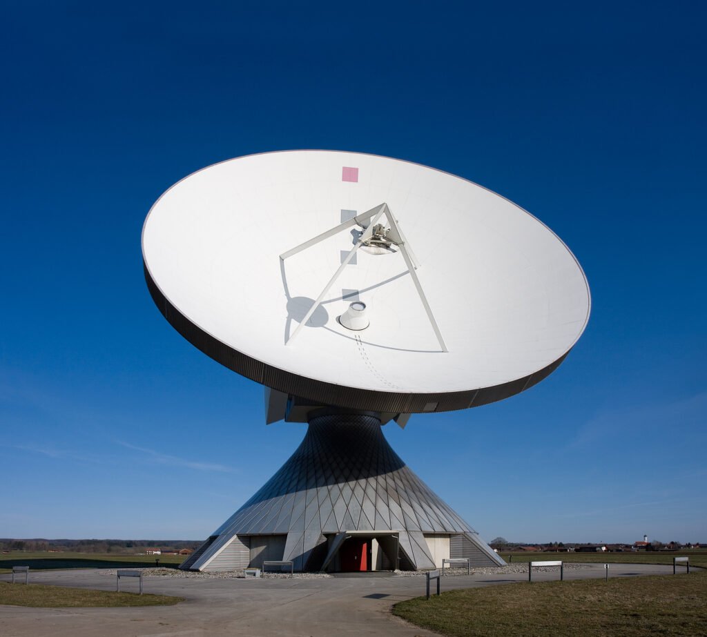
Satellite communication is the use of artificial satellites to relay radio signals between distant points on Earth, or between Earth and spacecraft. A ground station sends a signal up to a satellite, equipment on board processes it, and the satellite sends it back down to receivers that may be thousands of kilometers from the sender. It carries television, telephone calls, data and weather imagery, and it is most valuable where cables and towers are impractical.
History of satellite communication
The first experiments used no electronics for relaying at all. NASA’s records describe Echo 1, launched in 1960, as a balloon of mylar polyester film 30.48 meters across, designed as a passive reflector for transcontinental and intercontinental telephone, radio and television signals. Signals bounced off its surface instead of being amplified. The balloon also carried a beacon transmitter at 107.9 megahertz for telemetry, powered by nickel-cadmium batteries that 70 solar cells kept charged, and it re-entered the atmosphere on May 24, 1968.
Active satellites, which receive a signal and retransmit it, soon followed. Syncom 2, launched from Cape Canaveral on July 26, 1963, was the first geosynchronous satellite. Its orbit had a 24-hour period but was inclined 33 degrees to the equator, so it traced an elongated figure eight instead of staying fixed over one spot. It began regular service on August 16 and carried voice, teletype, facsimile and data between a ground station at Lakehurst, New Jersey, and a Navy ship at sea off the coast of Africa. NASA’s catalog calls the Syncom spacecraft forerunners of the Intelsat series.
Regulation developed alongside the hardware. The International Telecommunication Union, the United Nations agency for information and communication technologies, maintains procedures for submitting and registering satellite frequency assignments under its Radio Regulations, and it publishes information on satellite networks.
How satellite communication works
Every link has three parts: an uplink, a satellite and a downlink. A ground station transmits to the satellite on the uplink. A transponder on board, which combines a receiver and a transmitter, amplifies the weak signal and shifts it to a different frequency so that the strong outgoing signal does not swamp the incoming one. The satellite then sends it down to receivers within its coverage area.
The signals are radio waves, so they travel at the speed of light, and the length of the path sets a floor on the delay. A geostationary satellite sits roughly 36,000 kilometers above the equator, so a signal that travels up and back down covers at least 72,000 kilometers. That takes about a quarter of a second before any processing time is added. People on a geostationary telephone link notice this as a short pause between speaking and hearing a reply.
Because the radio spectrum is shared, interference has to be managed. Operators coordinate their frequencies and orbital positions through national regulators and the ITU, which is why a satellite network is filed and registered before it is brought into use. Most links use microwave frequencies, whose short wavelengths allow compact, highly directional antennas.
Types of satellite communication
Satellite systems are usually grouped by orbit, because the orbit decides coverage, delay and how many satellites a network needs.
In a geostationary orbit, NASA explains, a satellite circles directly above the equator with zero eccentricity and zero inclination, so it does not move relative to the ground. Because it stays over one spot, it can provide constant coverage for phones, television and radio. Weather satellites such as the GOES series use the same orbit to report on clouds, water vapor and wind every few minutes. The drawback is geometry: a satellite parked over the equator sits near the edge of view for places far to the north or south.
The Molniya orbit, a medium Earth orbit, was designed for those high latitudes. NASA notes that it is useful for communications in the far north or south and that Russian communications satellites use it.
Low Earth orbit begins just above the top of the atmosphere, and NASA says most scientific satellites travel there. A satellite in low orbit crosses the sky quickly and sees only a small part of Earth at a time. Networks built in low orbit therefore need many satellites working together to give continuous coverage, but each signal travels a much shorter distance than it would to a geostationary satellite.
Services differ as well. Some satellites broadcast to many receivers at once, some link fixed ground stations, and some connect moving ships, aircraft and handheld terminals.
Applications of satellite communication
Television and radio distribution is the longest-running use. A single transmission from a satellite can reach every receiver in its footprint, so broadcasters use it to feed programming to cable systems and homes over large regions.
Telephone and data links to ships, aircraft and remote sites depend on satellites where no cable or tower reaches. Satellite internet service carries ordinary Internet Protocol traffic over the radio link. After earthquakes, storms and floods have knocked out ground networks, portable satellite terminals can restore basic communication for responders. Satellites also relay weather data, as the GOES example shows, and connect scientific instruments and spacecraft to their operators.
Navigation signals also come from satellites, but navigation constellations are a separate technology from communication satellites, even though both depend on radio links from orbit.
Advantages and disadvantages of satellite communication
The main advantage is reach. A satellite covers oceans, deserts, mountains and polar regions where laying cable would be slow or costly, and it serves a wide area as easily as a small one. A new ground terminal can be added without building new infrastructure along the route.
The disadvantages are delay, cost and capacity limits. Geostationary links add a noticeable pause, building and launching a satellite is expensive, and a satellite’s radio capacity is finite and shared. Heavy rain can weaken signals at higher frequencies. Crowding of orbits and spectrum also raises sustainability questions, and the ITU runs a space sustainability gateway as part of its work on satellite networks.
Satellite communication vs. fiber optics
Undersea and terrestrial fiber-optic cables carry light through glass and form the backbone of long-distance data traffic. For a fixed route between two large cities, a cable usually offers more capacity and lower delay than a geostationary satellite, because the signal does not travel to orbit and back. Satellites are stronger where there is no cable, where users move, or where one signal must reach many places at once. The two are complementary, and many networks use both.
More in Networks & Telecommunications
Key facts
- Echo 1 was a 30.48-meter mylar balloon that served as a passive communications reflector.2
- Echo 1 re-entered the atmosphere on May 24, 1968.2
- Syncom 2, launched on July 26, 1963, was the first geosynchronous satellite.3
- Syncom 2 orbited at a 33-degree inclination, so it was not truly geostationary.3
- A geostationary satellite orbits directly above the equator and stays over one spot on the ground.1
- Low Earth orbit begins just above the atmosphere, and most scientific satellites use it.1
- The ITU maintains procedures for registering satellite frequency assignments under the Radio Regulations.4
Related concepts
Quick checkWhat was the first geosynchronous communications satellite?Show answer
It was Syncom 2, launched on July 26, 1963. Its orbit was inclined 33 degrees, so it was geosynchronous but not truly geostationary.
Sources
- 1. NASA Earth Observatory, Catalog of Earth Satellite Orbits, https://earthobservatory.nasa.gov/features/OrbitsCatalog
- 2. NASA NSSDCA, Echo 1 spacecraft record, https://nssdc.gsfc.nasa.gov/nmc/spacecraft/display.action?id=1960-009A
- 3. NASA NSSDCA, Syncom 2 spacecraft record, https://nssdc.gsfc.nasa.gov/nmc/spacecraft/display.action?id=1963-031A
- 4. International Telecommunication Union Radiocommunication Sector, Space Services, https://www.itu.int/en/ITU-R/space/Pages/default.aspx
Editorially reviewed by Specialty Digest Editorial TeamLast reviewed November 4, 2026Researched and drafted with AI assistanceReport an issue