The Alaska Marine Highway System (AMHS) is a state-run ferry service that connects coastal communities in Southeast, Southcentral and Southwest Alaska with each other and with Bellingham, Washington, and Prince Rupert, British Columbia. Its routes cover about 3,500 miles (5,600 km), and the system was officially established in 1963, building on a ferry business that began in 1948. It is operated by the Alaska Department of Transportation and Public Facilities, with headquarters in Ketchikan and its main hub at Juneau [1][2].
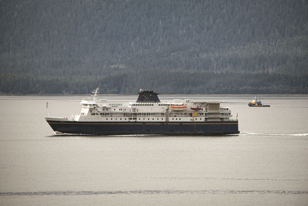
| Operator | Alaska Department of Transportation and Public Facilities |
|---|---|
| Established | 1963 (predecessor service from 1948) |
| Route length | About 3,500 miles (5,600 km) |
| Terminals | 32, across Alaska, British Columbia and Washington |
| Southern termini | Bellingham, Washington and Prince Rupert, BC |
| Annual traffic | About 350,000 passengers and 100,000 vehicles |
| Designation | National Scenic Byway and All-American Road |
Origins
The service began in 1948, when residents of Haines, Steve Homer, Ray Gelotte and Gustav Gelotte, founded Chilkoot Motorship Lines and bought the MV Chilkoot, a former Navy landing craft. The Territory of Alaska bought the business in 1951 after it faced bankruptcy. The MV Chilkat began daily service between Juneau, Haines and Skagway in 1957 [2].
Statehood and Expansion
Alaska became a state in 1959, and the Chilkat became the first state-owned ferry. The legislature passed the Alaska Ferry Transportation Act, and voters approved $18 million in bonds to expand the fleet [2]. The bond package was worth about $199 million in today’s dollars [1].
1963 and After
The Division of Marine Transportation was formally established in 1963, creating the Alaska Marine Highway System. In that year the MV Malaspina, MV Taku and MV Matanuska were added, serving Ketchikan, Petersburg, Sitka, Wrangell and Prince Rupert [2]. The Tustumena entered service from Kodiak in 1964 along with Southwest ports such as Cordova, Homer, Seldovia, Valdez and Seward [2].
Growth Through the Decades
Whittier, Port Lions and Tatitlek were added in 1968, creating a ferry-rail link to the Alaska Railroad. Service expanded along the Alaska Peninsula and Aleutian Chain between 1979 and 1993, including Dutch Harbor and Akutan. In 1989 the southern terminus moved from Seattle to Bellingham, and in 1998 the MV Kennicott linked the Lower 48 with South Central Alaska [2]. Between 2010 and 2012 the addition of Gustavus, Ouzinkie and Old Harbor brought the system to 35 communities [2].
Routes
The system has three regions: Southeast (mainline and day-boat service), Southcentral (Prince William Sound and Kodiak) and Southwest (the Alaska Peninsula and Aleutian Islands). It has 32 terminals in total across Alaska, British Columbia and Washington [1].
Federal Status
The system is part of the National Highway System and eligible for federal highway funding, and vehicles can travel between Alaska and the contiguous states without international customs and immigration [1]. Between 2002 and 2005 it was named a National Scenic Byway and an All-American Road, the only marine route with both designations [2].
Vessels
The Kennicott, which joined in 1998, provides mainline and cross-gulf service. The Tustumena serves Southcentral and the Aleutians, the Columbia runs the mainline, usually starting in Bellingham, and the Aurora serves Prince William Sound. The Tazlina, delivered in 2018, was the first Alaska-class vessel, followed by the Hubbard, launched in June 2023. The Matanuska has not offered passenger service since 2023 and has been used as a hotel ship, and the Taku has been retired [1][2].
Ridership
The system carries about 350,000 passengers and 100,000 vehicles per year; in 2008 it carried 340,412 passengers and 109,839 vehicles. Service is primarily transportation rather than leisure, with cabins at extra cost and mostly cafeteria-style food. Summer tourism is heavy, and service falls in winter [1].
Recent Challenges
A strike in 2019 shut down service for several days and cost $3.2 million. Cross-gulf trips have declined in recent years because of staffing and funding issues [1]. Many communities in the region have no road connection, so changes in ferry service directly affect residents and businesses.
Why the Ferries Matter
Most communities in Southeast Alaska, and many in Prince William Sound, Kodiak and the Aleutians, are not connected to the road system. The ferry system therefore moves residents, vehicles, groceries and freight, and carries visitors in summer. Because the system is part of the National Highway System, federal highway funds can support it, similar to a road [1].
Connections to Other Transport
The ferry connects with the road network at Haines and Skagway, with the Alaska Railroad at Whittier and with the Alaska Highway system through connecting routes. In 1968 the addition of Whittier created a ferry-rail link to the Alaska Railroad, extending the reach of the marine highway into the Interior [2].
Ferry Fleet in Transition
The fleet includes both older vessels and newer Alaska-class ferries. The Tazlina, delivered in 2018 and christened for service in Lynn Canal, was the first of the class, and the Hubbard followed in 2023. Meanwhile, ferries such as the Fairweather and Chenega were sold abroad in 2021–2022 and the Malaspina was retired to Ward Cove near Ketchikan [1][2].
Public Debate
Debates about the ferry system focus on funding, staffing and the balance between serving small communities and managing costs. Service drops in winter, and cross-gulf trips have declined in recent years because of staffing and funding issues [1]. Supporters emphasize the system’s role as essential transport, while critics point to operating costs.
FAQs
What is the Alaska Marine Highway? A state-run ferry system serving coastal Alaska communities and connecting them to Bellingham, Washington, and Prince Rupert, British Columbia.
When was the Alaska Marine Highway established? The system was formally established in 1963, with predecessor service from 1948.
How long are the ferry routes? About 3,500 miles (5,600 km).
Why do people use the ferry? Many Southeast Alaska towns have no road links, so the ferry carries people, vehicles and goods.
Where does the ferry start in the lower 48? At Bellingham, Washington, since 1989.
Sources
- Wikipedia: Alaska Marine Highway
- Alaska Department of Transportation and Public Facilities: History of AMHS
Key facts
Quick checkIn what year was the Alaska Marine Highway System established?Show answer
1963
Sources
- Wikipedia. Alaska Marine Highway. 2026 (accessed 2026-11-12)
- Alaska Department of Transportation and Public Facilities. History of AMHS. 2026 (accessed 2026-11-12)
Editorially reviewed by Specialty Digest Editorial TeamLast reviewed November 12, 2026Researched and drafted with AI assistanceReport an issue