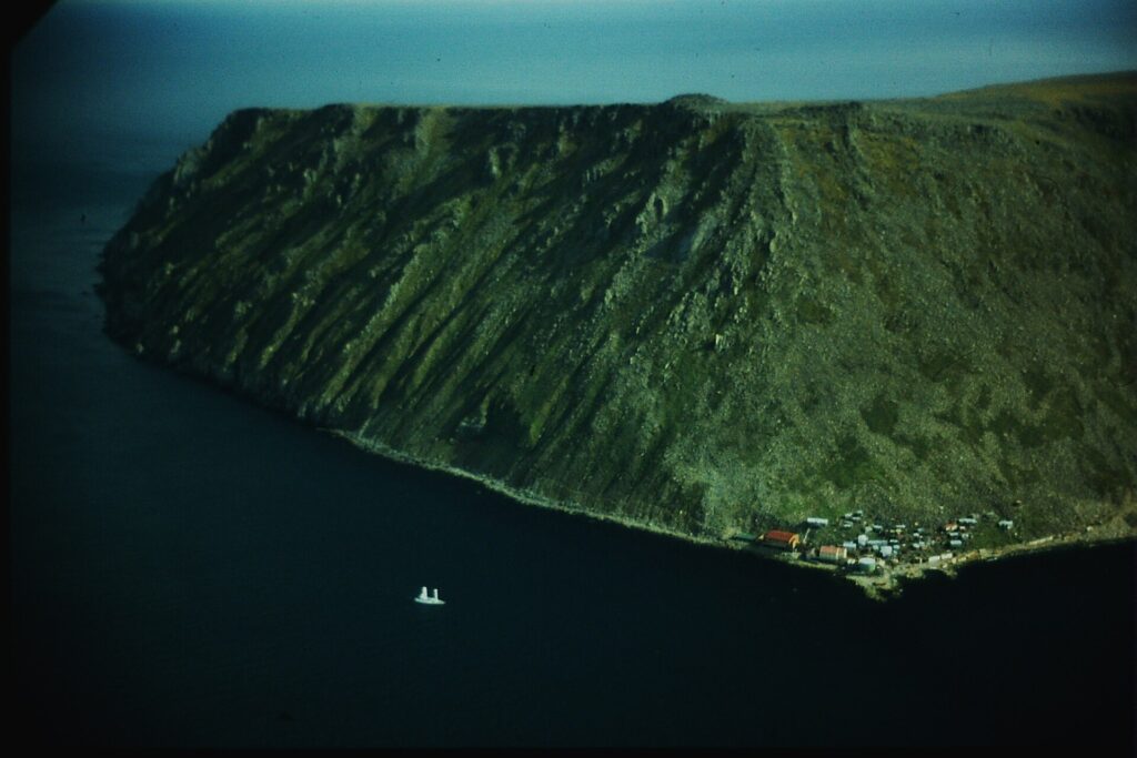
The Diomede Islands are two small islands in the Bering Strait, Big Diomede (Russia) and Little Diomede (United States), only about 3.8 km (2.4 miles) apart. The International Date Line runs between them, which has given Big Diomede the nickname Tomorrow Island and Little Diomede Yesterday Island. Little Diomede has a small Iñupiat village, while Big Diomede holds only military units [1].
| Combined area | About 35 km² (14 sq mi) |
|---|---|
| Distance apart | About 3.8 km (2.4 mi) |
| Date line | About 2 km from each island |
| Little Diomede population | 77 (January 2023) |
| Big Diomede population | 0 (military only) |
| Named | Saint Diomedes, 1728 |
Two Islands, Two Countries
Big Diomede belongs to Russia (Chukotka) and Little Diomede to the United States (Alaska). They cover about 35 km² combined, and the International Date Line runs between them near 168°58′37″ W, roughly 2 km from each island. Big Diomede is 21 hours ahead of Little Diomede, or 20 hours in summer [1].
Naming
The islands are named for Saint Diomedes, whose feast day was the day Vitus Bering sighted them in 1728. In Russia they are also known as the Gvozdev Islands. Russian geodesist Mikhail Gvozdev determined their position in 1732, and Semyon Dezhnev reported two islands in 1648, though it is uncertain whether they were the Diomedes [1]. See the entries on the Bering expeditions and the Bering Strait.
The Border
The 1867 U.S.–Russia treaty that completed the Alaska Purchase used the islands to mark the border, naming Krusenstern Island (Ignaluk) and Ratmanov Island (Nunarbuk). During the Cold War the strait between them formed the border between the United States and the Soviet Union and was called the Ice Curtain [1]. See the entry on the Treaty of Cession.
Little Diomede
The Iñupiat population fell from 170 to 115 by the 2010 census, and the island had 77 residents as of January 2023. The village of Diomede, on the island’s west side, has a school, a post office and a store, and some residents are known for ivory carving. Commercial flights serve it under the Essential Air Service when weather permits [1].
Big Diomede
After the Soviet Union set up a military base on Big Diomede in 1948, it moved the island’s Indigenous residents to the Russian mainland. The island is now inhabited only by military units and is the easternmost point of Russia [1].
Ice Bridge and Crossings
An ice bridge usually connects the two islands in winter. In 1987 Lynne Cox swam between them and was congratulated by both Mikhail Gorbachev and Ronald Reagan, and in 1995 Michael Palin began his BBC series Full Circle on Little Diomede [1]. The islands were once mountaintops in the central part of the Bering land bridge and are often cited as possible stops for a proposed Bering Strait bridge or tunnel [1].
FAQs
Which countries own the Diomede Islands? Big Diomede belongs to Russia and Little Diomede to the United States.
How far apart are they? About 3.8 km (2.4 miles).
What is the International Date Line’s role? It runs between them, making Big Diomede ahead by 21 hours.
Who lives on Little Diomede? A small Iñupiat village, 77 residents as of January 2023.
Can you walk between them? An ice bridge usually connects the two islands in winter.
Sources
More in Human Geography
Key facts
Quick checkWhich Diomede island belongs to the United States?Show answer
Little Diomede
Sources
- Wikipedia. Diomede Islands. 2026 (accessed 2026-11-12)
Editorially reviewed by Specialty Digest Editorial TeamLast reviewed November 12, 2026Researched and drafted with AI assistanceReport an issue