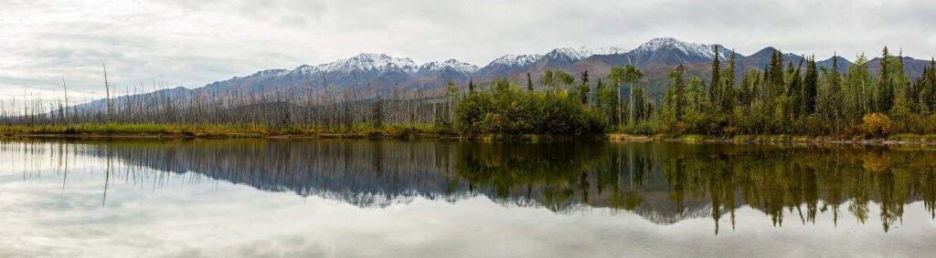
The geology of Alaska is shaped by its position on the Pacific Ring of Fire, where the North Pacific Plate subducts beneath the North American Plate. The result is an active volcanic arc, frequent large earthquakes, great mountain ranges and the largest glaciers in the United States. Alaska has the most coastline of any U.S. state, nearly 34,000 miles of tidal shoreline, and about 3 million lakes [1][2].
| Land area | 570,380 sq mi |
|---|---|
| Tidal shoreline | Nearly 34,000 miles |
| Glacier ice | About 16,000 sq mi of land |
| Highest peak | Denali, 20,310 ft |
| 1964 earthquake | Magnitude 9.2 |
| Tectonic setting | Pacific Ring of Fire |
Tectonic Setting
Alaska lies on the Pacific Ring of Fire. The southern side of the Alaska Peninsula was uplifted as the North Pacific Plate subsides beneath the North American Plate, and a small portion of the ancient Kula plate lies in the Bering Sea; it once subducted under Alaska [3][4]. The northern side of the peninsula is generally flat and marshy because of long-term erosion and seismic stability [3].
Mountains and the Denali Fault
The Alaska Range runs about 600 miles from Lake Clark to the White River in Yukon, with Denali at 20,310 feet the highest mountain in North America. The Denali Fault runs along the range’s southern edge and is responsible for many major earthquakes [5]. The Wrangell Mountains contain Mount Sanford [1].
Volcanoes
Many active volcanoes lie in the Aleutian Islands, including Mount Shishaldin on Unimak Island, rising to 9,980 feet, and the volcanic chain extends to Mount Spurr, west of Anchorage [1]. The Aleutian Range includes Katmai, Novarupta, Redoubt, Iliamna and Augustine [4], and Pavlof Volcano is the most active in the range on the Alaska Peninsula [3]. Cook Inlet volcanoes such as Redoubt and Augustine are newer, while the Wrangell volcanoes in the east are older [6]. See the entry on Novarupta and the 1912 Katmai eruption.
Earthquakes
On March 27, 1964, a magnitude 9.2 megathrust earthquake lasting 4 minutes 38 seconds struck Southcentral Alaska. It remains the most powerful recorded in North American history and the third most powerful in world history. Tsunami waves were noted in more than 20 countries, and the tallest, about 220 feet, was recorded at Shoup Bay [7].
Glaciers and Ice
Glacier ice covers about 16,000 square miles of land and 1,200 square miles of tidal zone. The Bering Glacier complex alone covers 2,250 square miles near the Yukon border [1]. Malaspina and Bering Glaciers reach the coast along the Gulf of Alaska [8].
Permafrost and Lowlands
Marshlands and wetland permafrost cover 188,320 square miles of the state [1], and discontinuous permafrost underlies much of the Interior, becoming continuous toward the Arctic [9]. See the entry on permafrost in Alaska.
Landforms Across the State
The Interior features large braided rivers and Arctic tundra, with the Yukon and Kuskokwim among the major braided rivers. Turnagain Arm, south of Anchorage, has tidal differences of more than 35 feet [1].
FAQs
Why does Alaska have so many earthquakes? The North Pacific Plate subducts beneath the North American Plate along the Pacific Ring of Fire, and faults such as the Denali Fault add to the activity.
How strong was the 1964 earthquake? Magnitude 9.2, the most powerful in North American history.
What is the highest mountain in Alaska? Denali, at 20,310 feet.
How much of Alaska is covered by glaciers? Glacier ice covers about 16,000 square miles of land.
Does Alaska have active volcanoes? Yes, many, especially in the Aleutian Islands and Alaska Peninsula.
Sources
- Wikipedia: Geography of Alaska
- Wikipedia: Alaska Range
- Wikipedia: Alaska Peninsula
- Wikipedia: Bering Sea
- Wikipedia: Alaska Range (peaks and fault)
- Wikipedia: Southcentral Alaska
- Wikipedia: Prince William Sound
- Wikipedia: Gulf of Alaska
- Wikipedia: Interior Alaska
More in Earth Sciences
Key facts
Quick checkWhat was the magnitude of the 1964 Alaska earthquake?Show answer
9.2
Sources
- Wikipedia. Geography of Alaska. 2026 (accessed 2026-11-12)
- Wikipedia. Alaska Range. 2026 (accessed 2026-11-12)
- Wikipedia. Alaska Peninsula. 2026 (accessed 2026-11-12)
- Wikipedia. Bering Sea. 2026 (accessed 2026-11-12)
- Wikipedia. Alaska Range (peaks and fault). 2026 (accessed 2026-11-12)
- Wikipedia. Southcentral Alaska. 2026 (accessed 2026-11-12)
- Wikipedia. Prince William Sound. 2026 (accessed 2026-11-12)
- Wikipedia. Gulf of Alaska. 2026 (accessed 2026-11-12)
- Wikipedia. Interior Alaska. 2026 (accessed 2026-11-12)
Editorially reviewed by Specialty Digest Editorial TeamLast reviewed November 12, 2026Researched and drafted with AI assistanceReport an issue