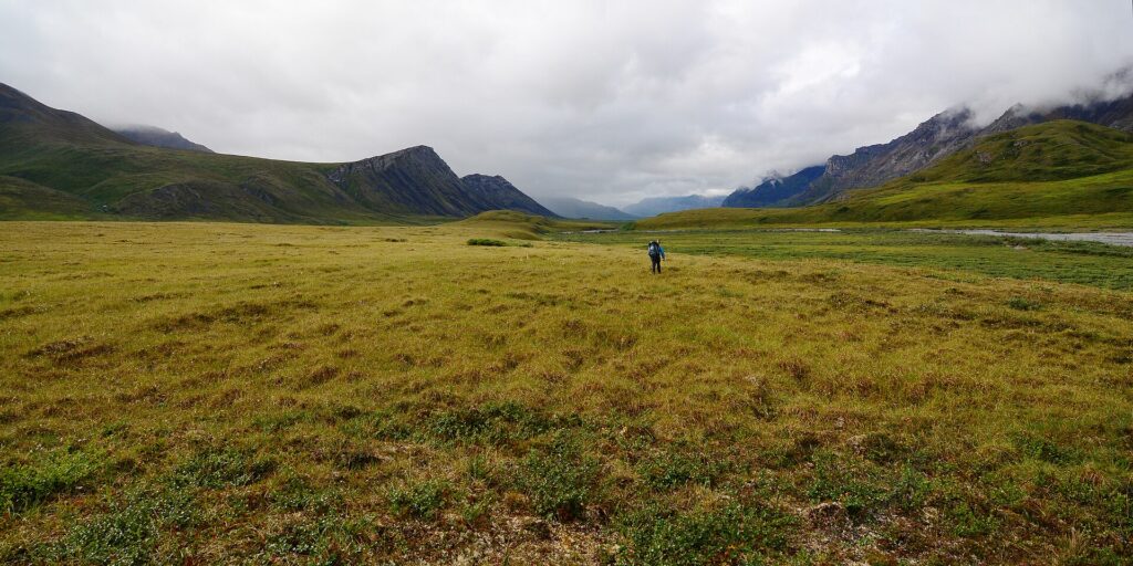
The Brooks Range is a mountain range in northern Alaska and the Yukon, about 700 miles (1,100 km) long from east to west and roughly 150 miles wide. Its highest point is Mount Isto at 8,976 feet. It forms North America’s northernmost continental drainage divide and the northern limit of trees, and it is crossed by the Dalton Highway and the Trans-Alaska Pipeline at Atigun Pass [1].
| Length | About 700 miles (1,100 km) |
|---|---|
| Width | About 150 miles (240 km) |
| Highest point | Mount Isto, 8,976 ft |
| Named | 1925, for Alfred Hulse Brooks |
| Pass | Atigun Pass, 4,643 ft |
| Age | About 126 million years |
Geography
The range runs about 700 miles east to west, from northern Alaska into Canada’s Yukon Territory, and is roughly 150 miles wide. Its highest point is Mount Isto at 8,976 feet; Mount Hubley reaches 8,914 feet and Mount Chamberlin 8,898.6 feet. The Gates of Kiev, at 7,775 feet, is the highest point in the central range [1].
Geology
The range formed during the Laramide orogeny from Cretaceous-era rock and is said to be about 126 million years old. Its rocks originated in an ancient seabed, so they contain marine fossils, including Middle Cambrian trilobites and brachiopods in the sandy limestones of the central range [1].
Naming
The U.S. Board on Geographic Names named the range in 1925 for Alfred Hulse Brooks, who led USGS geology work in Alaska from 1903 to 1924. The Gwich’in name is Gwazhał. The U.S. treats the range as a subrange of the Rocky Mountains, while Canada treats it as separate [1].
Drainage Divide and Tree Line
The range forms North America’s northernmost continental drainage divide, separating streams that flow to the Arctic Ocean from those that flow to the North Pacific, and it marks the northern limit of trees. Black spruce grows on southern slopes, and warming has pushed the tree line northward while shrubs increase in former tundra areas [1].
Protected Areas and Settlements
Gates of the Arctic National Park, the Arctic National Wildlife Refuge and Noatak National Preserve protect parts of the range. The only settlements are the Alaska Native villages of Anaktuvuk Pass and Arctic Village plus small communities such as Coldfoot, Wiseman, Bettles and Chandalar. The Red Dog mine in the De Long Mountains is described as the world’s largest zinc mine [1]. See the entry on Gates of the Arctic National Park and Preserve.
Dalton Highway
The Dalton Highway and the Trans-Alaska Pipeline System pass through Atigun Pass, at 4,643 feet, on the way to the Prudhoe Bay oil fields [1].
Wildlife and Climate
Mammals include Dall sheep, grizzly bears, black bears, gray wolves, moose and the Porcupine caribou, whose migration is described as the longest of any land mammal. The region has warmed about twice as fast as southeastern Alaska, and perennial snowfields shrank from 34 square miles in 1985 to under 4 square miles in 2017 [1].
FAQs
How long is the Brooks Range? About 700 miles.
What is its highest peak? Mount Isto, 8,976 feet.
Who is it named for? Alfred Hulse Brooks, a USGS geologist.
What crosses it? The Dalton Highway and pipeline at Atigun Pass.
Which parks protect it? Gates of the Arctic, ANWR and Noatak.
Sources
More in Earth Sciences
Key facts
In the news
Quick checkWhat is the highest point in the Brooks Range?Show answer
Mount Isto
Sources
- Wikipedia. Brooks Range. 2026 (accessed 2026-11-12)
Editorially reviewed by Specialty Digest Editorial TeamLast reviewed November 12, 2026Researched and drafted with AI assistanceReport an issue