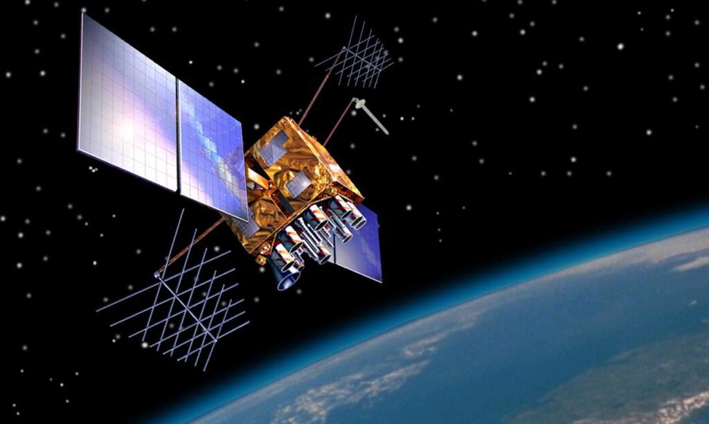
The Global Positioning System, or GPS, is a satellite navigation service owned by the United States that provides positioning, navigation and timing to users around the world. A receiver works out its three-dimensional position and the time from radio signals sent by satellites that orbit about 20,200 kilometers above the Earth. The civilian service is free to use.
History of GPS
NASA traces the origins of GPS to the Sputnik era, when scientists found they could follow the satellite by the shift in its radio signal, known as the Doppler effect. That idea became a foundation of modern satellite navigation. In the early 1970s the U.S. Department of Defense wanted a robust and stable navigation system, built on earlier ideas from Navy scientists, and it chose to base the system on satellites.
The first Navigation System with Timing and Ranging satellite, known as NAVSTAR, was launched in 1978. Eleven experimental Block I satellites were launched between 1978 and 1985, followed by 28 operational Block II and IIA satellites from 1989 to 1997. NASA dates the full operation of the 24-satellite system to 1993.
The satellites have been replaced in generations. The Block IIR series flew from 1997 to 2004, the modernized IIR-M satellites from 2005 to 2009, and the first Block IIF satellite was launched on May 28, 2010. Satellites have often outlasted their plans: the Block II and IIA craft were designed for 7.5 years, yet they averaged almost 26 years in service, and the last was retired in 2019, according to the European Space Agency‘s Navipedia.
For years the public signal was deliberately degraded. This was called Selective Availability, and it was imposed for national security reasons. In May 2000, at the direction of President Bill Clinton, the U.S. government stopped using it so that GPS would serve civil and commercial users better. In 2007 the government announced that future GPS III satellites would be built without the feature at all.
How GPS works
The system has three parts. The space segment is a nominal constellation of 24 satellites arranged in six orbital planes, inclined 55 degrees to the equator, with four slots in each plane. This arrangement ensures that users can see at least four satellites from virtually any point on the planet. Each satellite circles the Earth twice a day.
Each satellite carries redundant atomic clocks, a type of clock that keeps time by the steady vibrations of atoms, and transmits its position and the time at regular intervals. A receiver determines where it is by calculating how long the signals took to reach it. Since radio waves travel at a known speed, the delay of each signal converts into a distance.
The control segment is a global network of ground facilities that track the satellites, monitor their signals and send commands and updated data to the constellation. It includes a master control station, an alternate master control station, 11 command and control antennas and 16 monitoring sites. The user segment is the receiver equipment in phones, vehicles, aircraft and instruments.
Types of GPS service and signals
GPS offers two levels of service. The Standard Positioning Service uses the coarse acquisition code on the L1 frequency and is available to everyone, continuously and worldwide, without direct user charges. The Precise Positioning Service uses a P(Y) code on both L1 and L2 and is restricted to U.S. armed forces, federal agencies and selected allied governments.
Newer satellites broadcast more civil signals. The Block IIR-M generation added a second civil signal, L2C, and Block IIF added a third on the L5 frequency. GPS III satellites add a fourth, L1C. GPS.gov states that the United States has committed to keep at least 24 satellites operating 95 percent of the time, and the Space Force has flown 31 operational satellites for well over a decade.
Accuracy of GPS
GPS.gov states that accuracy depends on satellite geometry, signal blockage, atmospheric conditions and receiver quality. A GPS-enabled smartphone is typically accurate to within a 4.9 meter radius under open sky, and worse near buildings, bridges and trees. The government commits to broadcasting the signal in space with an average user range error of 2.0 meters or less, with 95 percent probability. FAA data cited by GPS.gov show high-quality single-frequency receivers reaching horizontal accuracy of 1.82 meters or better, 95 percent of the time. Dual-frequency receivers and augmentation systems can reach a few centimeters in real time.
Common causes of error include blocked signals, indoor or underground use, and signals that bounce off buildings. Less common ones are interference, jamming, major solar storms and satellite maintenance. Many apparent GPS errors are actually faulty maps, such as mislabeled businesses or missing roads, which the satellite system does not control.
Applications of GPS
GPS.gov groups uses under agriculture, aviation, environment, marine, public safety and disaster relief, rail, recreation, roads and highways, space, surveying and mapping, and timing. Professional surveying and aviation depend on it. Timing is a major use, because GPS delivers time to within about 10 nanoseconds. NASA also uses GPS to determine spacecraft orbits and trajectories, and navigation features in an autonomous vehicle are one of many modern services built on its signals.
Advantages and disadvantages of GPS
Global coverage, continuous operation, free civilian access and timing precision are the main strengths. The weaknesses lie at the receiver and in the radio signal. Signals are easily blocked, and GPS.gov lists indoor and underground use among the main causes of degraded accuracy, along with the reflections that tall buildings create. GPS.gov also maintains pages on jamming and on the resilience of positioning, navigation and timing services, because interference can disrupt receivers.
More in Networks & Telecommunications
Key facts
- GPS is a U.S.-owned utility providing positioning, navigation and timing, made up of space, control and user segments.1
- The first NAVSTAR satellite was launched in 1978, and NASA dates full operation of the 24-satellite system to 1993.4
- GPS satellites fly in medium Earth orbit at about 20,200 kilometers and circle the Earth twice a day.2
- Six orbital planes of four slots each let users see at least four satellites from virtually any point on Earth.2
- Smartphones are typically accurate to within a 4.9 meter radius under open sky.3
- Selective Availability, a deliberate degradation of the public signal, was discontinued in May 2000.6
Related concepts
In the news
Quick checkWhat does a GPS receiver measure to work out where it is?Show answer
It measures how long radio signals from several satellites took to arrive. Each satellite sends its position and the time, and the delay of each signal gives a distance.
Sources
- GPS Overview, GPS.gov, https://archive.gps.gov/systems/gps/
- Space Segment, GPS.gov, https://archive.gps.gov/systems/gps/space/
- GPS Accuracy, GPS.gov, https://archive.gps.gov/systems/gps/performance/accuracy/
- What is GPS?, NASA, Catherine G. Manning, September 25, 2023, https://www.nasa.gov/missions/tdrs/what-is-gps/
- Control Segment, GPS.gov, https://archive.gps.gov/systems/gps/control/
- Selective Availability, GPS.gov, https://archive.gps.gov/systems/gps/modernization/sa/
- GPS Space Segment, Navipedia, European Space Agency, https://gssc.esa.int/navipedia/index.php/GPS_Space_Segment
Editorially reviewed by Specialty Digest Editorial TeamLast reviewed November 4, 2026Researched and drafted with AI assistanceReport an issue